How do thunderstorms and lightning form, and how does METEORAGE detect them? We are eager to share our knowledge, from thunderstorm formation to lightning detection, upon which we have been continuously building since 1987.
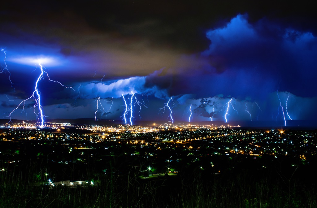
365 days of thunderstorms worldwide, 350 in Europe per year
Every day, an average of 7 million lightning flashes are detected, 10% of which strike the ground. A lightning flash (an electric discharge of up to 200,000 amperes) always seeks the shortest path between the cloud and the ground. As a result, lightning is more likely to strike pointed, conductive objects.
Certain sites and locations are more exposed due to their configuration and height: monuments, towers, wind turbines and so on. Lightning can therefore strike the same place twice (or more)!
In a context of climate change, thunderstorms appear to be more severe and the duration of the stormy season longer. Contrary to popular belief, there is also plenty of thunderstorm activity during winter. Lightning flashes with high amplitudes are detected despite a low lightning density.
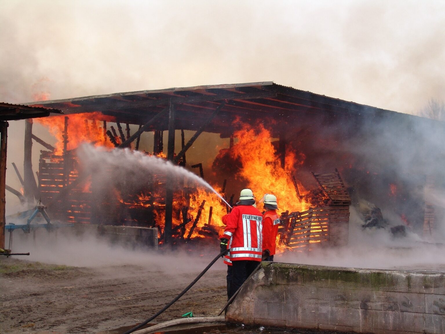
Considerable damage
Lightning is essential to life, as it maintains our planet’s electrical field, but this natural hazard with which we have to live represents a source of severe risks.
Every year, thunderstorms and lightning are responsible for over 20,000 deaths on Earth.
Lightning also generates direct and indirect damage to business and infrastructures, causing fires, including forest fires, industrial accidents, destruction of equipment, electrical disasters, GSM antenna failures, etc.
Monuments regularly struck by lightning:
(number of strikes over the last 10 years)
37
Eiffel Tower
68
Berlin TV Tower
230
Empire State Building
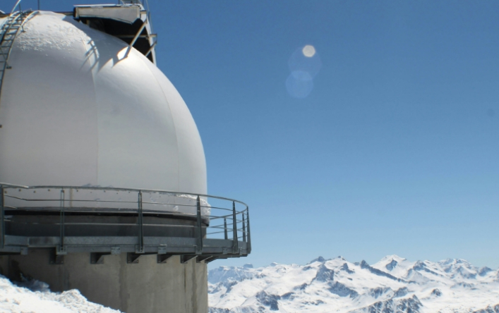
1874
Pic du Midi de Bigorre
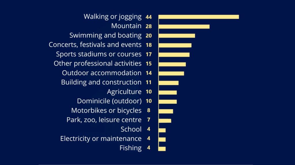
Types of activities carried out by lightning victims in Europe, between 2010 and 2020 (%)
Most thunderstorms can be anticipated and are not sudden
Nine out of ten thunderstorms can be anticipated, particularly in terms of how they will develop within the hour. Accidents are often due to a lack of anticipation, or even vigilance, in the face of an approaching thunderstorm.
According to a study analyzing lightning accidents over the last ten years in Europe, 60% of victims were taking part in outdoor leisure activities, and 20% involved occupational accidents. The majority of accidents occurred outside the periods of greatest risk (during the orange/red warnings issued by the national meteorological services).
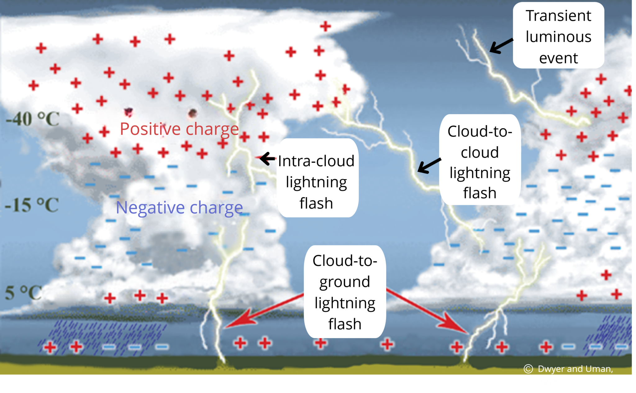
Warm, moist air near the ground rises into the atmosphere in a process known as convection.
This moist air condenses at higher altitudes, forming a cloud. The cumulus cloud turns into a cumulonimbus, the thundercloud. This cloud is made up of rain droplets and solid particles.
Collisions between these particles electrify the thundercloud.
The electric charges are distributed over 3 superimposed levels.
Lightning flashes occur between two zones of opposite charge.
There are 3 main types of lightning flashes:
cloud-to-ground,
intra-cloud,
cloud-to-cloud.
Electric currents flowing along ionized channels emit electromagnetic waves.
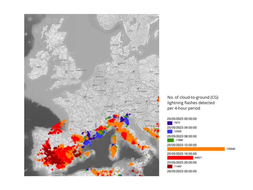
The 4 main types of thunderstorms
Heat thunderstorms
These thunderstorms form mainly by convection in zones where the vertical temperature gradient is high.
They are more difficult to anticipate because they depend on local forcing.
Heat thunderstorms in Europe on May 25, 2023:
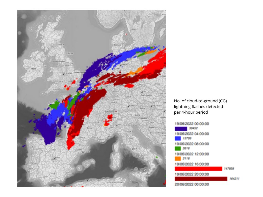
Pre-frontal thunderstorms
These thunderstorms, most frequent in European latitudes, are extensive, affecting several hundred kilometers.
Frontal thunderstorms are easier to anticipate, due to their linear configuration, with a generally southwest/northeast direction.
Frontal thunderstorms in Europe on June 19, 2022:
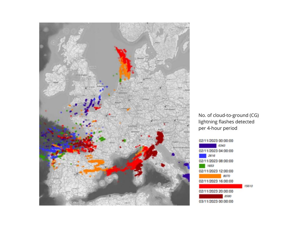
Cold air-mass thunderstorms
These thunderstorms occur behind a cold front, in a cold, highly disorganized air mass. The very cold air at high altitude leads to convection and the development of these thunderstorms.
They are difficult to anticipate because they are triggered randomly, compared with pre-frontal thunderstorms.
Convective thunderstorms in Europe on November 2, 2023:
Orographic thunderstorms
These isolated thunderstorms often form very rapidly over mountainous areas (Alps, Apennines, Pyrenees, etc.).
They happen when orographic forcing occurs causing the air to rise and condense, forming cumulonimbus clouds.
They are easier to anticipate.
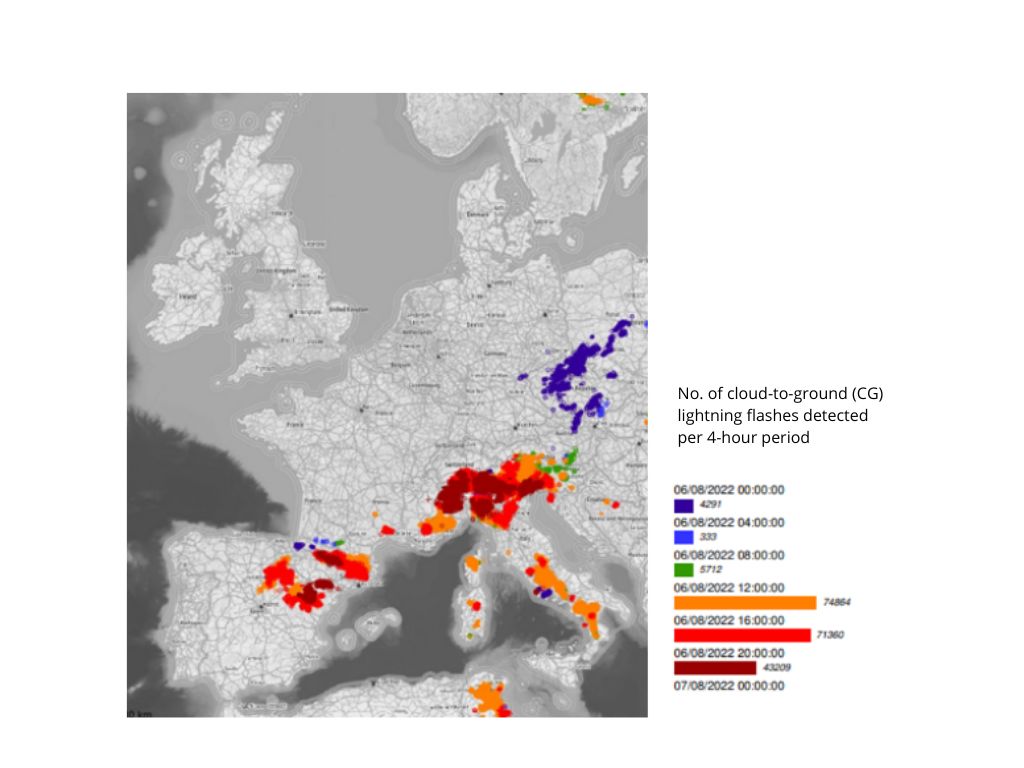
Orographic thunderstorms in Europe on August 6, 2022:
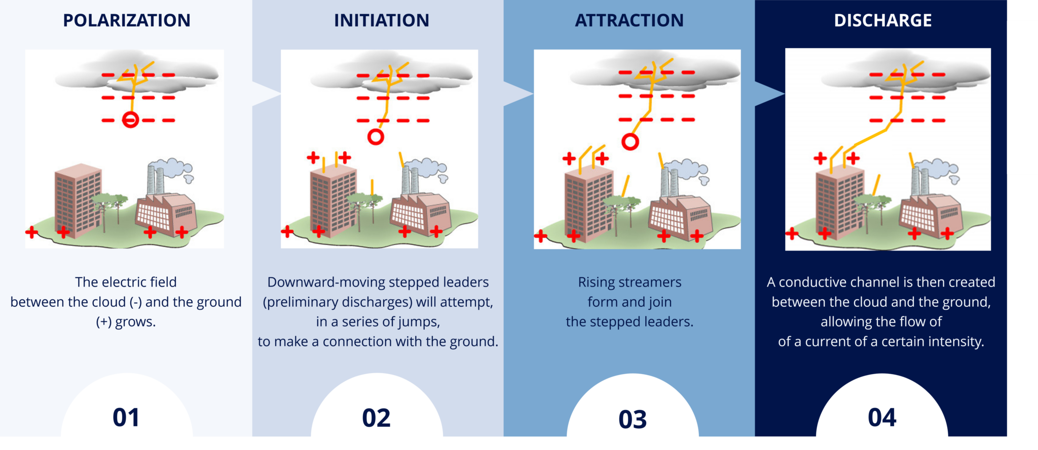
The formation of negatively-charged downward-moving cloud-to-ground (CG) lightning flashes
An electric field strong enough to make the air conductive is required to produce a lightning flash.
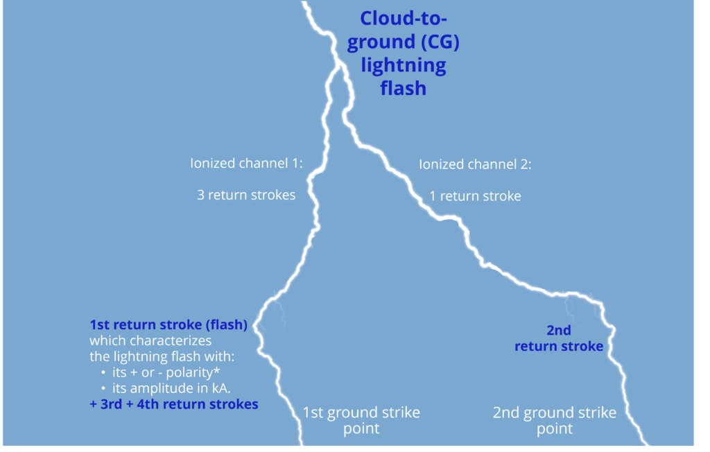
Structure of a cloud-to-ground (CG) lightning flash
Analysis of a cloud-to-ground lightning flash composed of 2 ground strike points and 4 return strokes:
A cloud-to-ground (CG) lightning flash can produce one or more ionized channels that connect the cloud to the ground.
The electric currents flowing along these ionized channels emit radio signals.
The endpoint of a channel is called a “ground strike point“.
One or more current pulses, known as “return strokes”, flow through a channel.
* depending on the polarity of the charge in the cloud that initiated the leader.
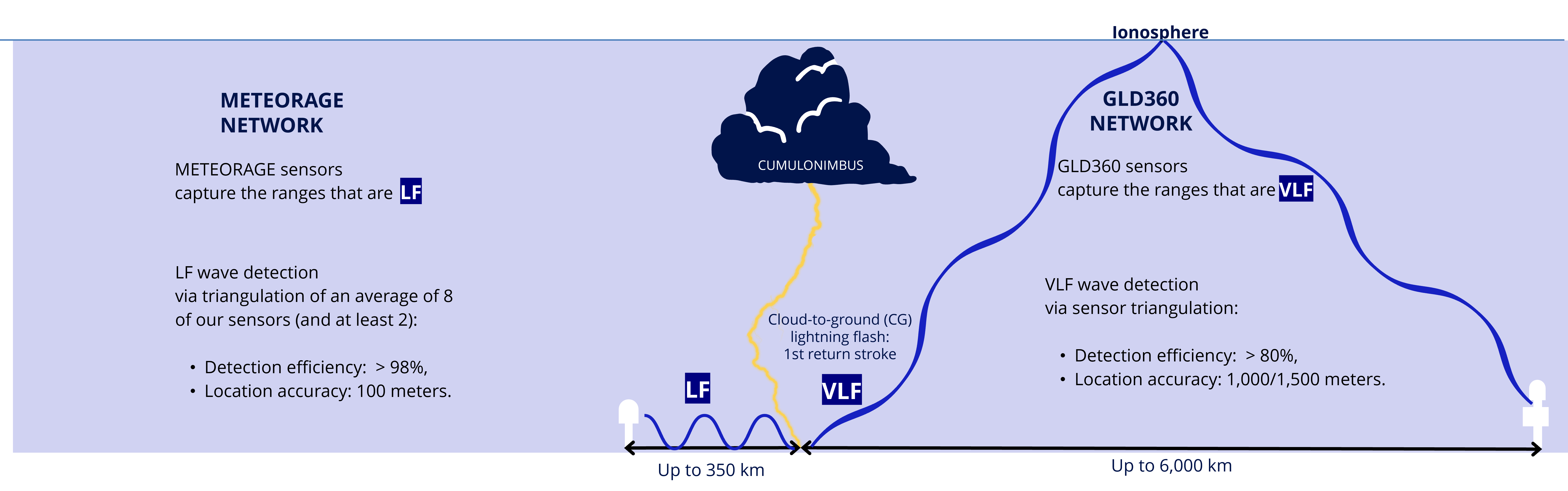
Types of cloud-to-ground (CG) lightning flash radio signals and their detection
A lightning flash is made up of a series of electrical processes.
The return stroke emits electromagnetic signals, and radiates in the following spectra:
VLF (very low frequency) atmospheric waves.
LF (low frequency) ground waves.
visible frequency.
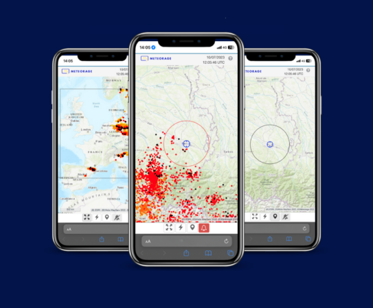
Detection of cloud-to-ground (CG) lightning flashes by the METEORAGE (ELDN) and GLD360 networks:
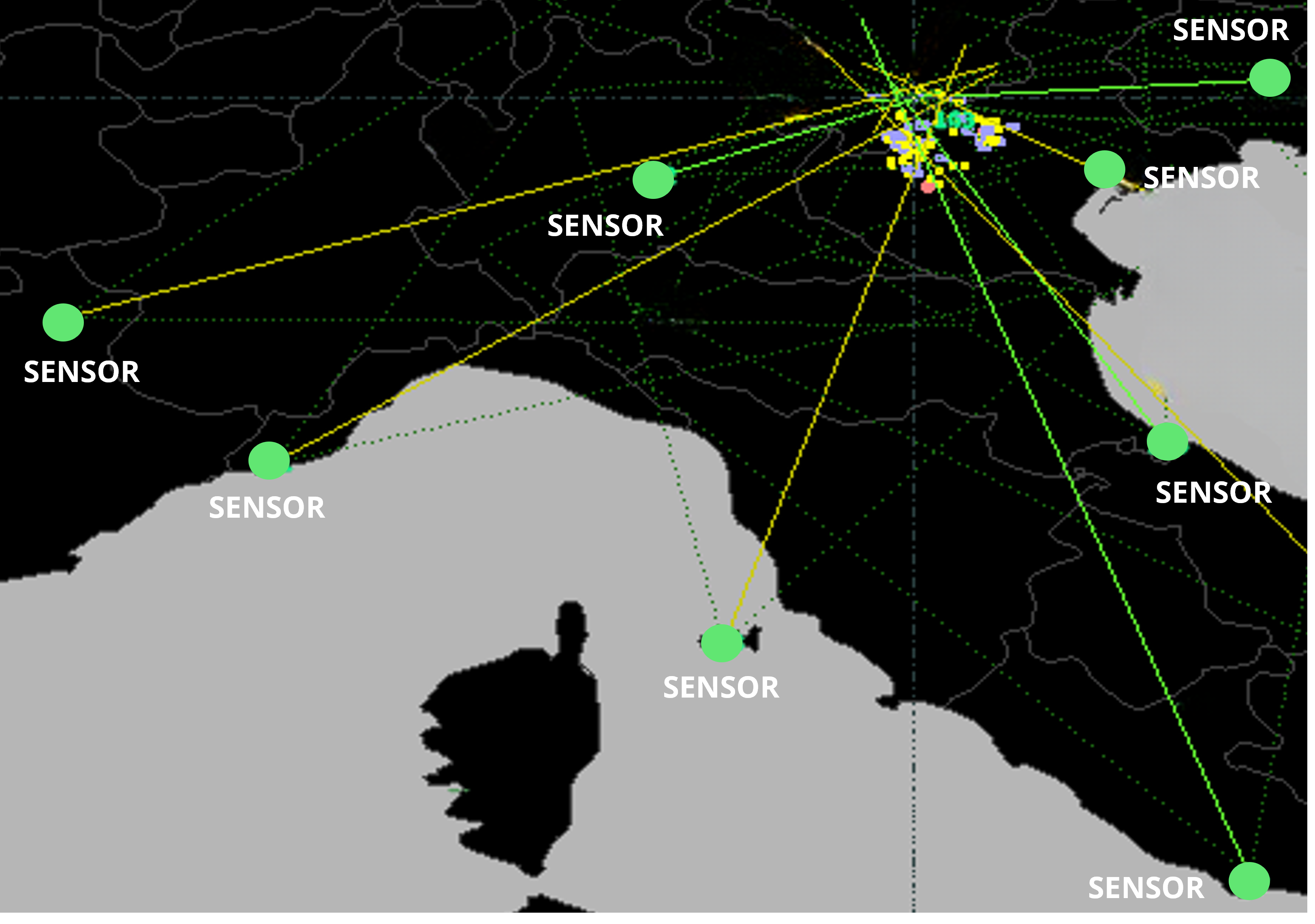
Location via a lightning network: how does it work?
The Vaisala sensors used by our European lightning detection network transmit two location parameters for each lightning flash:
the time of arrival,
the angle of arrival.
Using the IMPACT method, the network combines these two parameters to optimize the location calculation and obtain better data quality than with time of arrival alone used by traditional detection networks.
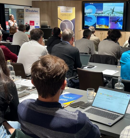
Expand your knowledge of lightning meteorology
Watch the replay of our webinar “Introduction to lightning Meteorology | The lightning dataset in meteorological applications.”